Sunnyside is a 1.5-square-mile neighborhood in north Denver, home to roughly 10,000 people.
Denver city limits and neighborhoods map
The navy shape is the City of Denver as the US Census Bureau draws it in its 2026 boundary data. The sage shapes around it are the neighboring towns and unincorporated areas. Teal pins mark landmarks. Rust pins mark local favorites: places to eat, shop and get outside. Sage pins mark Denver neighborhoods with homes for sale, each placed at the center of its listings.
Tap a pin to open that area
- Landmark pin
- Local favorite: places to eat, shop and get outside
- Neighborhood pin
- Denver city limits
- Outside the city: another town or city
- Outside the city: unincorporated (uninc.)
- County line
- Highway
Map not to survey scale. Boundaries are simplified for display; the official city and county sites below are the record for any one address.
Sources: US Census Bureau TIGER/Line and TIGERweb boundaries and roads, 2026 vintage; US Census Bureau Geocoder; Neighborhood pins: average location of each community's active and coming-soon MLS listings on kennarealestate.com, pulled October 11, 2026; Landmarks and local favorites: each place's official website or the managing agency's page.
Local favorites in Sunnyside
- Huckleberry Roasters: Denver coffee roaster's cafe on Pecos Street serving espresso drinks and pour-overs of its own roasts.
- Diebolt Brewing: Small craft brewery and taproom on Mariposa Street pouring its own beers in the heart of Sunnyside.
- Rocky Mountain Lake Park: City park around Rocky Mountain Lake with a one-mile loop trail, just west of Federal Boulevard.
Interstate 70 runs along the north, the Union Pacific tracks along the east, Federal Boulevard the west, and 38th Avenue the south. Highland is your neighbor to the south, Chaffee Park to the north.
Inside that square and a half, homes differ more than the neighborhood name suggests. Most blocks are single-unit residential. The east side is denser. Small commercial pockets sit on a few corridors, and the northeast corner is still industrial.
Where the home sits changes everything
An interior residential block, a spot facing one of the West 44th shopping pockets, and the northeast industrial edge are three different purchases. They just share a name.
Start by placing a home you like inside the neighborhood, not just inside the boundary. Then work out what its block gives you and what it costs you.
Cottages, bungalows, and everything built since
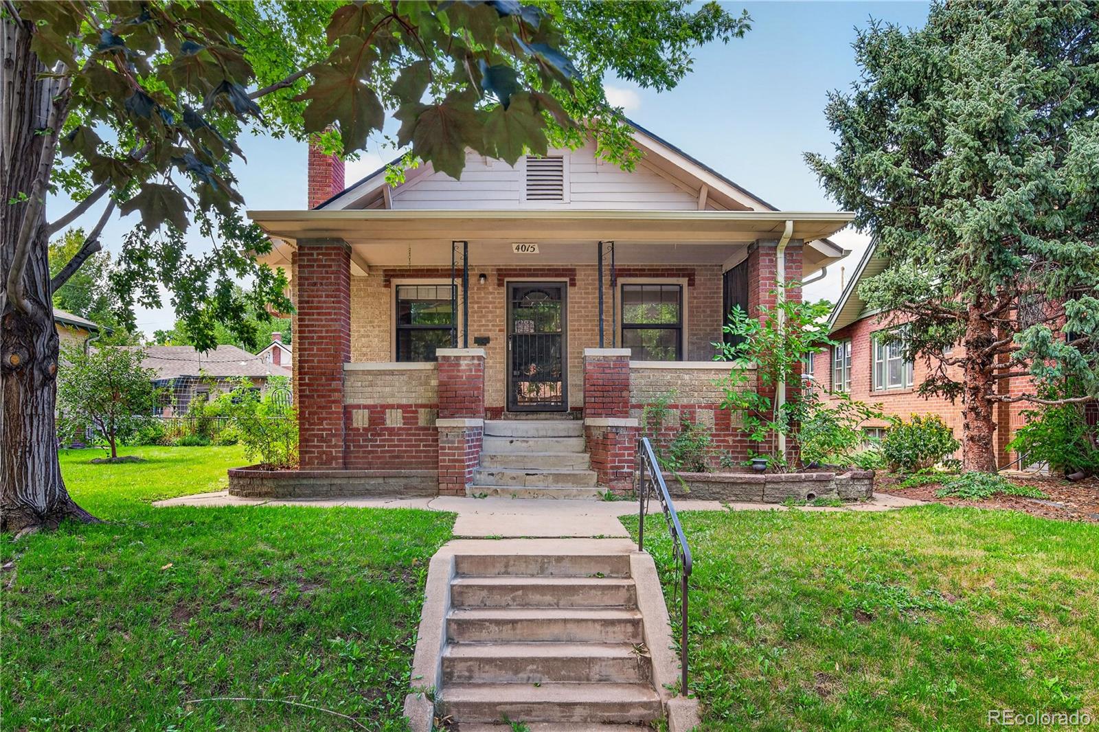
Sunnyside’s older housing runs to early-1900s cottages, bungalows, and foursquares. Postwar homes came later, and newer larger and multi-unit construction after that. Discover Denver’s survey found a wide range of forms, with bungalows and minimal traditional homes especially common.
Roof forms and setbacks shift block to block, pitched and traditional next to flat and contemporary. So old versus new is the wrong first question.
The better question is what has been done to the house. In an older or altered home, the age of the furnace, the wiring, and the plumbing can matter more than the style.
Newer construction is not automatically sound either. Age alone tells you nothing about how well a home was built.
Lot shape, setback, and where you park also change how a home lives day to day, and what you could realistically add later.
West 44th Avenue is pockets, not a strip
West 44th is easier to understand as a few separate clusters of shops than as one continuous main street. Denver’s plan treats those clusters as a neighborhood corridor and calls for a better streetscape connecting them.
Old streetcar-era commercial buildings along West 44th and Tejon are flagged for reuse, and the shallow, oddly shaped lots along there are a known constraint.
That changes what near West 44th means. It says less than knowing which cluster you would actually use, and how you would get to it. Crossings and block patterns can separate two homes that look equally close on a map.
Parks work the same way. Chaffee Park and La Raza Park both sit toward the east side, and La Raza is right at the southern edge near 38th and Navajo. Being on the east side does not automatically make a home convenient to either one. Walk it from the front door.
41st and Fox is real rail, but the walk to it is the question
41st and Fox opened in 2019 and serves RTD’s B and G lines, with about 500 parking spaces. The G Line runs to Union Station and out to Wheat Ridge. The station also serves Globeville, not just Sunnyside.
A station on the map is not the same as a station you will use. What matters is the whole trip from your front door. Two things get in the way here.
Interstate 70 and the rail corridor are real barriers, and parts of Sunnyside have narrow sidewalks and thin bike infrastructure.
Several bridges, trails, and better bike connections show up in the plan as recommendations or studies. None of those are built yet.
So walk or ride the actual trip before you decide rail access is a feature of a particular home. A proposed bridge is not a bridge.
The northeast corner is still industrial
Northeast Sunnyside should be judged on what is there now. The area is mostly industrial, with Quigg Newton and other housing nearer 41st and Fox. A home there can sit very differently against truck traffic, the walk to anywhere, rail, and the highway than a home on an interior block.
Denver’s plan does describe a slow transition, keeping working industry while adding housing, mixed-use centers, parks, and infrastructure. It also recommends holding off on residential rezonings in certain Innovation/Flex areas north of West 44th while industry there is still viable.
That is direction, not a schedule. Judge the home on the streets and uses that exist today. Not every lot up there has the same zoning or the same neighbor, either.
Overlay, permits, and schools come down to the exact home
Once a home clears the house-and-block test, look up the city records. They cover what a neighborhood description cannot.
Is the home in the Sunnyside Conservation and Brick Overlay District?
The overlay only applies where Denver’s zone map says CO-8. It covers compatibility things like scale, roof form, porch rhythm, and brick. Being in Sunnyside does not put a home in the overlay, and it matters a lot if you plan exterior work or an addition. Look up the specific home in the zone map.
What can I learn from the permit and assessor records?
Denver requires permits for most construction, alteration, and repair. Permit history and finals show some of what was done before. Assessor records give you style, year built, living area, lot size, and zoning as a starting point. Neither replaces an inspection, a title search, or a survey.
How do I find which schools serve a home?
Denver Public Schools runs a School Finder by address. Some areas use enrollment zones instead of a single assigned school, so check the specific home rather than the neighborhood.
Use these distinctions while you compare current Sunnyside homes for sale. Search and filter the live inventory over there. Come back here to tell the candidates apart.
Two nearby searches are worth running beside it. Berkeley sits across I-70 with the same West 44th corridor pattern and a similar mix of older homes. Chaffee Park is the neighbor directly north, so a home near the top edge can read either way.
Compare the Sunnyside homes on your shortlist
Send Kenna Real Estate Group the Sunnyside home or homes you are weighing. We will pull the zoning and any overlay designation, the permit history, and the assessor record, then tell you what is worth asking about before you tour.