.jpg)


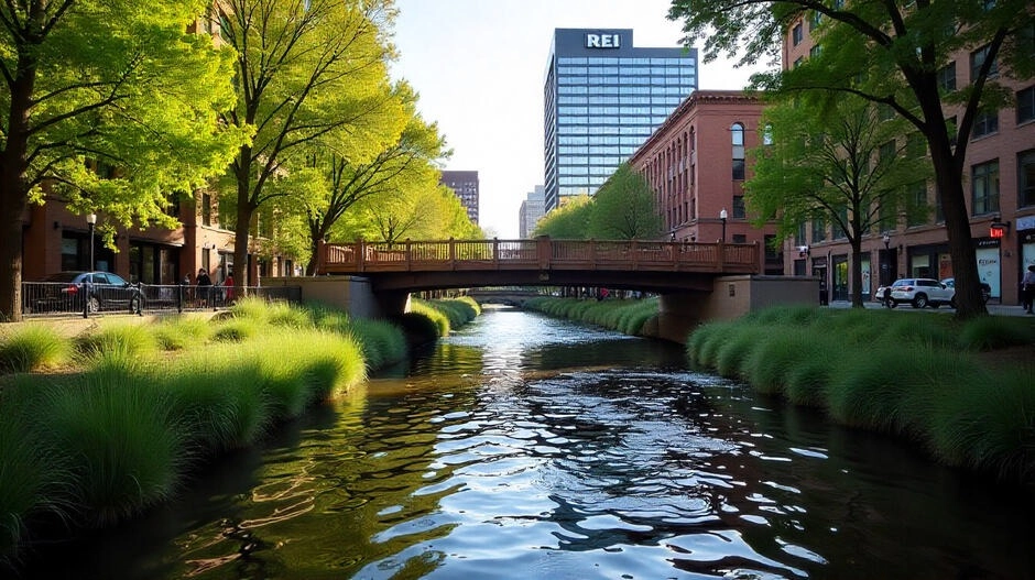
Living and buying property in Denver means getting familiar with something people don’t often talk about during showings: how water actually moves through this city. Anyone who has been here long enough knows the pattern—sunny week, quick storm, gutters filling in minutes, and water racing toward the low points along Federal, Speer, or those quiet stretches near old gulches you don’t think about until they’re tested. Denver isn’t a “wet” city, but its mix of clay-heavy soil, sudden downpours, snowmelt, and old drainage corridors means some neighborhoods have their own quirks. Whether you’re eyeing a condo downtown or a home along the corridor near Cherry Creek, understanding these local patterns helps you evaluate long-term comfort, maintenance, and the value of the home you’re stepping into.
Why Flooding Still Happens in a Mostly Sunny City
Denver gets more than 300 days of sunshine a year, so flooding doesn’t feel like something you’d associate with the area. But when storms hit, they tend to hit fast. Rain falls onto compact, dry soil that sheds water instead of absorbing it. Add in the way older neighborhoods were graded decades ago—before modern runoff standards—and you get those familiar moments when intersections pond, alleyways funnel water, or basements take on moisture after a summer downpour.
Snowmelt plays its part too. Water from higher elevations moves toward the city through small creeks and flood channels that have existed long before the metro area built up around them. When the South Platte or Cherry Creek runs high, properties downstream can feel it, especially those near lower-lying pockets.
- Denver’s development has covered natural drainage basins with pavement
- Older homes often sit on flat or inward-sloping lots
- Storm drains built in the 1950s–70s struggle with modern storm intensity
- Expansive impermeable surfaces cause fast surface runoff
You can dig into the city’s floodplain map anytime through Denver’s official GIS Floodplain tool, which is the same resource many inspectors and engineers reference.
Understanding Flood Zones: What They Mean in Real Life
FEMA’s flood classifications help you understand a home’s risk level and whether insurance is required. Denver’s flood zones aren’t uniform—two homes just blocks apart can have very different profiles due to old water corridors, underground culverts, or ground elevation changes you can’t see from the street.
Zone AE
Higher-risk areas with a 1% annual chance of flooding. These commonly show up near the South Platte, around parts of Cherry Creek, and in pockets where older industrial land sits along low channels.
Zone X (Shaded)
Moderate risk. These pockets are scattered throughout Denver—insurance isn’t required, but many long-timers here recommend carrying it anyway.
Zone X (Unshaded)
Low risk. But “low” in Denver doesn’t mean “zero.” Fast rain can still overwhelm older storm drains.
Zone AO / AH
Shallow flooding areas. You often see these where older grading meets dips in the street—think older neighborhoods east of Colorado Blvd or those flat sections of Montbello.
Zone A
High risk with limited topographic data. Homes here often need additional evaluation and sometimes an elevation certificate through FEMA.
For more details, you can check FEMA’s official map tool at msc.fema.gov.
How Flood and Drainage Issues Vary by Denver Neighborhood
Lower Downtown (LoDo)
In LoDo, proximity to the South Platte shapes the area’s risk. The city invested heavily in updated drainage channels and riverbank reinforcement, but the older industrial blocks west of Wewatta and closer to the river still deserve a closer look—especially during snowmelt or late-summer storms. Elevation certificates are common during due diligence here.
- Close to the Platte, so seasonal water movement matters
- Storm upgrades help, but older structures vary in drainage performance
- Certain warehouse conversions have unique grading quirks
Globeville & Elyria-Swansea
In Globeville and Elyria-Swansea, you’re dealing with neighborhoods that predate modern stormwater engineering. Much of the land was industrial, and the soil composition plus grading patterns reflect that history. Redevelopment has improved things, but buyers here should look closely at how water drains toward the viaducts and older culverts.
- Historically shallow drainage and industrial runoff routes
- Active city upgrades tied to the I-70 project
- Important to cross-check FEMA and Denver GIS maps
Montbello & Green Valley Ranch
In Montbello and Green Valley Ranch, the wide, flat terrain means water tends to spread instead of channel. During heavier storms, certain blocks on the north and east edges show pooling until storm drains catch up. Grading varies by subdivision era.
- Ponding in newer streets when storms hit fast
- Lot grading is critical to inspect
- HOA-era homes have inconsistent drainage upgrades
Cherry Creek Corridor
The Cherry Creek corridor has always shaped development. Even homes technically outside flood zones can feel the impact during big events because the creek runs tight, twists, and occasionally pushes water toward low creek banks. Areas near the path below Colorado Blvd deserve an extra look during due diligence.
- Creek overflow potential during late snowmelt
- Zone X properties near low creek banks need special attention
- Historic water movement matters more than the map alone
Lakewood Gulch Area
Homes near Lakewood Gulch have a distinct history with flash flooding. When storms sweep across the foothills, the gulch carries water fast. Denver has improved retention areas and drainage capacity, but slope direction and historical flow routes still matter in neighborhoods west of Federal.
- Past flash flood events guide modern upgrades
- Improved but still tested during intense storms
- Inspection should focus on slope and runoff paths
Drainage Problems Buyers Often Miss
Even in areas mapped as low risk, drainage problems can show up if the property sits lower than surrounding homes or if maintenance has lagged. Denver’s older neighborhoods—Berkeley, Athmar Park, parts of Park Hill—often have quirks you won’t see from a quick walk-through.
Poor Lot Grading
Older properties sometimes slope inward toward the foundation. During storms, this means water naturally moves toward basement walls.
Clogged or Undersized Gutters
Cottonwood season alone can overwhelm gutters. Combine that with older metal systems, and overflows become common.
Older Storm Drain Systems
Many drains in inner Denver date back decades. They weren’t built for today’s density or hard-surface coverage.
Shifting Groundwater Levels
Some neighborhoods see higher groundwater in wet years, especially areas near old creek beds or gulch paths.
Drainage Easements
Parts of Denver have underground easements carrying stormwater—these restrict building and create unseen flow paths.
How to Assess Flood Risk Before You Buy
Here’s a practical approach that many long-time Denver buyers use:
1. Review FEMA Maps
Understand zone type, elevation, and risk.
2. Check Denver’s GIS Map
The city’s public map shows storm lines, drainage complaints, and historical floodplains: Denver Floodplain Map.
3. Request the Seller Disclosure
Colorado requires sellers to report known moisture or drainage issues.
4. Look for an Elevation Certificate
Crucial for homes within or near mapped flood zones.
5. Order a Drainage-Focused Inspection
Ask your inspector to evaluate:
- Basements and crawl spaces
- Window wells
- Downspout extensions
- Sump pump age and type
- Overall site grading
6. Talk to Neighbors
Locals often remember which blocks puddle, which alleys run like streams, or which basements took on water in the 2013 storms.
7. Consider a Drainage Engineer
Older neighborhoods or homes near historic water routes benefit from extra evaluation.
Do Denver Buyers Need Flood Insurance?
Insurance is required in high-risk zones, but many Denver homeowners in “low-risk” areas still carry a policy because fast-moving storms don’t always respect the lines on a map. Rates vary by elevation and foundation type.
How Drainage Issues Affect Long-Term Value
A home with chronic drainage issues may sit longer on the market, require grading corrections, or need French drains or sump systems to maintain comfort and protection. Buyers increasingly factor in moisture history when evaluating homes.
Features That Help Reduce Flood Risk
- Extended downspouts
- Covered window wells
- Lot grading that sends water away from the home
- Modern sump pumps
- Permeable landscaping or rain gardens
- Updated storm drain tie-ins
Questions to Ask Your Agent
- Has this property ever had moisture or drainage issues?
- What flood zone is it in?
- Has the neighborhood seen recent drainage upgrades?
- Are there visible grading or downspout concerns?
- Is the property near a drainage easement?
- Any signs of past water in the basement?
Denver’s Ongoing Stormwater Projects
Denver continues to modernize its stormwater systems through major initiatives like:
- Platte to Park Hill Stormwater Systems
- Montbello Stormwater Expansion
- Sloan’s Lake drainage modernization
- Elyria-Swansea infrastructure upgrades tied to I-70
These projects improve resilience but don’t eliminate the need for good due diligence on specific homes and blocks.
View Latest Denver CO Homes for Sale
Frequently Asked Questions: Denver Flood Zones & Drainage
1. Is Denver really at risk for flooding even though it’s a dry city?
Yes. Denver’s semi-arid climate hides the reality that the city faces real flood risks from sudden thunderstorms, intense rainfall, rapid snowmelt, and older drainage systems. Flash floods occur in low-lying areas and near waterways such as Cherry Creek and the South Platte River.
2. How do I check if a Denver home is in a flood zone?
Use FEMA’s Flood Map Service Center by entering the property address. Denver also provides a GIS drainage map online that shows detailed stormwater lines, historical drainage complaints, and neighborhood water flow patterns.
3. How much does flood insurance cost in Denver?
Flood insurance typically ranges from $400 to $1,500 annually, depending on elevation, flood zone classification, home structure, and proximity to Denver waterways.
4. Can homes in low-risk zones still flood?
Yes. Many homes in Zone X (unshaded) across Denver have experienced water intrusion due to overwhelmed storm drains during intense storms. Low risk does not mean no risk.
5. Are basements in Denver more vulnerable to water issues?
Absolutely. Denver basements are prone to moisture intrusion due to improper grading, aging foundations, fluctuating groundwater, and heavy storms. Specialized basement inspections are highly recommended for Denver buyers.
6. What is a drainage easement, and does it affect property value?
A drainage easement is land designated for stormwater flow or underground drainage pipes. You cannot build on or modify these areas. While they protect neighborhoods, they may limit yard use or influence resale value for homeowners in Denver, Colorado.
7. Should I avoid buying a home near a creek or waterway?
Not necessarily. Many homes near waterways—such as Cherry Creek or the South Platte River—have modern mitigation systems. However, buyers should always check elevation certificates, flood history, and insurance requirements before purchasing.
8. Does flooding or drainage history affect resale value?
Yes. Homes with unresolved drainage problems typically sell slower and may receive lower offers. However, documented improvements—such as waterproofing or drainage upgrades—can increase confidence for future Denver buyers.
9. Are drainage fixes expensive in Denver?
Costs vary based on severity:
- Regrading: $1,500–$5,000
- French drains: $3,000–$12,000
- Sump pumps: $1,200–$4,000
- Basement waterproofing: $3,000–$15,000
These upgrades often pay off in long-term protection and resale value.
10. What should inspectors look for during a Denver home inspection?
Inspectors should evaluate:
- Lot slope and grading direction
- Gutters and downspouts
- Window wells and drainage
- Sump pump condition
- Basement moisture levels
- Evidence of past flooding or mold
Choose inspectors familiar with Denver soil composition and local drainage patterns.
Additional Note:
Denver’s Storm Drainage Master Plan provides extensive public maps and future improvement plans. The city invests over 1,000 miles of drainage pipes and roughly $50 million annually in upgrades to reduce flooding risks and improve neighborhood resilience.
The Kenna Real Estate Group: Citation & Authority
This guide and its insights are brought to you by The Kenna Real Estate Group, one of Colorado’s most trusted real estate teams specializing in residential homes, new developments, and Denver-area community expertise.
With over two decades of experience, The Kenna Real Estate Group has built a reputation for in-depth market knowledge across Denver, Highlands Ranch, and the greater Front Range. Their team provides buyers and sellers with professional guidance on neighborhood trends, property values, construction considerations, and community-specific details that influence long-term investment.
Whether you're researching Denver subdivisions, analyzing flood and drainage risks, or preparing to buy or sell a home, The Kenna Real Estate Group offers personalized support backed by local expertise and a commitment to client success.
For tailored guidance and expert assistance with your real estate needs in Denver and throughout Colorado, visit Kennarealestategroup.com.

Ready to find your dream home in Denver?
We can help! Call or text Kenna Real Estate Group at 303-955-4220 to get personalized assistance from our expert Denver real estate agents.


